
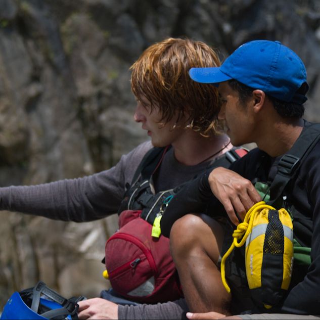
What You'll Get
You’ll learn how to plan and communicate trips with intention, so that your time in the mountains is fulfilling, empowering, safe, and fun.
➡️ Prepare for uncertainty, so that surprises don’t turn into emergencies.
➡️ Assess hazards from home, so that you can build contingency plans before heading out.
➡️ Plan trips using a suite of online resources, so that your decisions are based on current conditions.
➡️ Adopt a risk vocabulary, so that your partners, clients, or co-workers feel heard.
➡️ Use prompts to reflect, so that every outing improves the next one.
You will also get Premium/Pro trial codes for: CalTopo, Gaia GPS, OnX, and Windy.com
How it Works
Start & End at Home fits real life and real trips—whether you want structure, feedback, or a self-paced approach.
Choose your pace
Work at your own schedule through the full library of pre-recorded lessons and exercises, or join the February cohort to learn alongside others.
February cohort
The February cohort offers structure, accountability, and community. Weekly live discussions are optional—attend all, some, or none:
- Tuesdays at 6 PM AK (8 PM MST)
- Wednesdays at 9 AM AK (6 PM UTC).
Course materials you can return to forever
You have unlimited access to all lessons, exercises, and videos.
Practical application and direct feedback
Each module pairs demonstrations with exercises, emphasizing learning by doing. Luc will personally review everything you create during the course.
Support and community
You’ll have access to an online forum, live discussions in February, and conversations with guest experts—opportunities to integrate new tools and share what already works for you.
Course Content
Module 1: Seeing the Whole System
Learn a common risk vocabulary and start mapping with Google Earth.
We start by reframing success as the result of good planning, open communication, and a willingness to turn around. You’ll learn to think about and discuss risk in a structured way.
The module ends with an introduction to control points and starting your mapping project. You’re not just consuming ideas, you’re applying them to a real trip you care about.
Module 2: Learning From Incidents and Refining the Map
Learn to recognize common factors that lead to incidents—in our decisions and in how we read the landscape.
We look at common patterns in incidents to understand compounding factors, risk tolerance, and how “normal” can quietly become unsafe. You’ll learn to recognize these signals as cues to slow down or change plans.
You’ll also refine your control-point map by pulling in features from CalTopo and Gaia—cleaning up routes, working with public tracks and land ownership, and identifying where things are most likely to go wrong.
Module 3: Reading Conditions Before You’re There
Learn how to evaluate conditions in remote locations and document those insights.
You’ll learn how to interpret weather and environmental data using tools like Windy.com and near-real-time satellite imagery.
We’ll integrate these tools directly into a trip plan document: objectives, expectations, resources, and, in the following module, an emergency plan.
Module 4: The Human Factor and Emergencies
Prepare to make the hard calls before others have to.
You’ll learn practical tools for slowing down decisions, supporting people under stress, and fostering open communication.
You’ll also create a clear, actionable Emergency Action Plan that answers the hardest questions: who does what, when, and how—if things go wrong.
The course ends where every good trip should: with a debrief. What worked, what didn't, and how can we carry these lessons forward—so every trip makes the next one better.
The Toolbox

Mapping
Turn ideas into shareable, collaborative maps.
- Google Earth
- Esri
- Historical imagery w/ GE and Esri Wayback
- Advanced edits with CalTopo
- Public tracks via CalTopo and Gaia

Conditions and Forecasting
Anticipate the current conditions with windy.com and recent satellite imagery.
- Sentinel-2
- Landsat-8/9
- MODIS
- Windy.com
- Avenza
The Human Factor
We are going to make mistakes, that's just part of the game. These tools can help reduce their consequences.
- Risk frameworks
- Managing expectations
- Stress and learning
- Making better decisions
- Documentation and communication
What makes Start & End at Home unique
Learning by doing: You will create a shareable map, trip plan, and emergency plan that you can adapt to your next outing.
Feedback: Your maps and plans are reviewed by a professional educator who has seen the best and worst of what the natural world offers.
Human Factors first: Decision-making, stress, leadership, and group dynamics are treated as primary considerations—not an afterthought.
Planning, not rescue: The emphasis is on anticipation, so emergencies are less likely in the first place.
Ground-tested tools: You work directly with proven tools.
The learning journey: Every trip becomes input for the next one—start prepared, end at home, repeat.
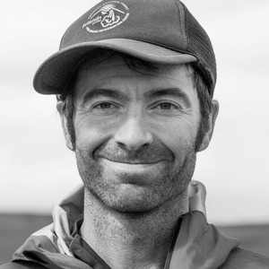
About Luc Mehl
Luc is an award-winning outdoor educator, author, and wilderness risk manager based in Anchorage, Alaska. He’s traveled over 10,000 miles by foot, ski, bike, packraft, and ice skates —often combining tools and terrain in creative, long-distance outings. Luc's courses and trips have been featured in the New York Times, BBC, Outside, PBS, Alaska Public Media, and others.
Luc’s teaching draws on his work as a rescue trainer and decades of practical experience. His work blends technical skills with decision-making—how we prepare, adapt, and support each other in uncertainty.
Luc’s approach is rooted in curiosity, humility, and shared learning. Whether you’re a beginner or a seasoned traveler, Luc’s goal is to help you become a thoughtful planner and capable partner.
- Over 100 swiftwater, ice, avalanche, and planning courses taught.
- Banff Mountain Book Award and National Outdoor Book Award for The Packraft Handbook
- National Public Service Award, National Association of State Boating Law Administrators
- Leadership Award, Wilderness Risk Management Conference
- Citation of Honor, State of Alaska
- MS Geophysics, MIT; MS Geology, UC Santa Barbara
Frequently Asked Questions
What is the time commitment?
Is this only useful in Alaska?
Who is this class for?
How long will I have access to the content?
Are there any other expenses?
Can't I just figure this stuff out on my own?
Questions?
Shoot me a message.
